View from Above the Sea of Japan - Aerial Train- Course
空から見下ろす日本海~空中列車~コース
 |
Route map
Route directions and land marks
- 1) Amarube Roadside Station
- Starting at Amarube Roadside Station cross National Road No. 178. Then cross the vermilion color bridge over the river and you will be greeted by “Benten-san” that watches over Amarube’s sea.
- 2) Gohan Hatake Observation Deck
- From there travel for about 5 mintues, go through the village until you reach the promenade leading to “Takanosu no Mori”. Climb up the winding dirt road for about 15 min. and there is “Gohanbata Tenbo-sho” view point where you can overlook the nearby Amarube Viaduct. If you walk for about another 5 minutes there is another overlook where you can see “Matsugasaki Hyaku So Gai (hundred-layer cliff)” Cliffs.
- 3) Takanosu Observation Deck
- From here continue on for another 5 minutes till you reach “Takanosu Observation Deck”, rest here.
- 4) Yoroi Station
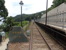
- From Takanosu Observation Deck go down the promenade for about 15 minutes and proceed to the right, you will reach Yoroi Station. Yoroi Station is an unmanned station, which was also used for in the design for the “Seishun 18 Kippu” poster and where they shot scenes for the drama “Futari Ko. From the first line’s platform there is a magnificent view over the brilliantly clear waters and Sea of Japan. Then, during the Golden Week holidays you can see approximately 80 carp streamers gently ”swimming” in the sky over Yoroi Harbour.
- 5) Juni Shrine
- Go down the slope from the station into the village, visit the “Juni Shrine” on the opposite shore and after you have taken in the sites of this fishing village head back to Yoroi Station.
- 6) Amarube Station
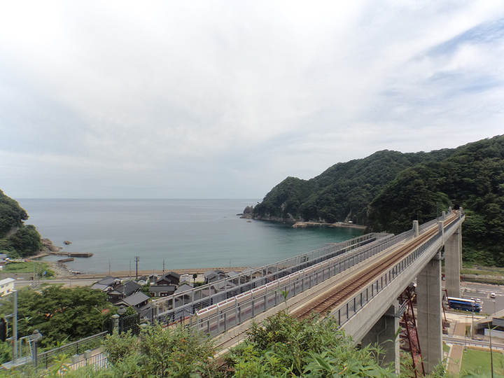
- Take the train on the JR San-in Main Line from Yoroi Station (about a 5 min ride) to Amarube Station, the next station. While on the train savor the view over the sea from Amarube Viaduct and the illusion the train is flying through the air.
When you get off at the next station, Amarube Station, take a moment to enjoy the view of the town from the Sky Station.
Although Amarube Viaduct is now a concrete bridge, before its reconstruction it was an iron trestle bridge that operated on the San-in Main Line for nearly 100 years since 1912. Three bridge piers have been preserved and the observation deck was reborn as the “Sky Station”. (Elevator completed in September 2017)
- Route
- Amarube Roadside Station > Takanosu no Mori (forest) > Yoroi Station > Sky Station (Amarube Viaduct Bridge) > Amarube Roadside Station
- Difficulty
- ★☆☆
- Route Category
- Mountain, seaside and railway
- Type of Activity


★☆☆ Flat course(Elevation gain less than 100m)or less than 5km.
★★☆ Slightly undulating course(Elevation gain less than 500m)or less than 10km.
★★★ Rugged course(Elevation gain more than 500m)or 11km.
★★☆ Slightly undulating course(Elevation gain less than 500m)or less than 10km.
★★★ Rugged course(Elevation gain more than 500m)or 11km.
| Distance | About 4km |
|---|---|
| Required Time | Walking time of about 1.5 hours. |
| Starting Point | Start / End point: Amarube Roadside Station |
| Getting Here | By Train: From JR Amarube Station walt to Amarube Roadside Station (道の駅 あまるべ). By Car: Go to Amarube Roadside Station |
| Road Conditions | Asphalt, concrete, gravel |
| Resting Place | Public restroom: Amarube Roadside Station & Yoroi Station Rest area: Takanosu Observation Deck Shops: Kobayashi Liqour Store (One-Yen Train goods, sake) |
| Signpost Presence | Not Present |
| Guide Availability | Available Contact: Kami Town Walking Network Council Office Phone: 0796-36-2467 (Kasumi B&G Ocean Center) |
| Notes |
The Takanosu trail is difficult to traverse in the snow. |
| Contact | Contact: Kami Town Hall Tourism Commerce and Industry Division Phone: 0796-36-3355 |
- Kinki Long-Distance Nature Trail - Mt. Taishi hiking course
- Nekozaki Peninsula Hiking Course
- Walk around Takeda Castle ruins and Teramachi Street
- The Famous Scenic "Kasumi Kaigan" Shiokaze Course
- Visit one of Japan's 100 most secluded regions, Torokawa Valley and Mt. Torokawa mountain trail.
- Mt. Sobu & Mt. Oosugii to Oonuka Mountain Trail
- Walking Hamasaka Town
- Yumura Onsen Course
- Moroyose Course
- Ueyama Highlands Course
- Tajima Mihonoura Course
- Home of Silkworm Culture - Osugi & Kuragaki Route
- Mining Town Walking Course in Akenobe
- View from Above the Sea of Japan - Aerial Train- Course
- Exploration of History Through Muraoka Castle Town
- Hachikita Kogen Scenic Walking Course
- Japan’s Most Beautiful Village - Tour Kami Town Ojiro & Kusube Valley Falls
- Japan’s Most Beautiful Village - Kami Town Ojiro, Giant Tree Forest, Yoshitaki Falls
- Walk Around Kuchiganaya in Ikuno Town
- Uduka History Course - Legend of the Rabbit Burial Mounds
- Uwano Nature & Interaction Forest Course
- Highland Course of a Shimmering Starry Forest and Pond
- See Oriental White Storks Dance in the Sky
- Walk the Town Where Oishi Riku Once Lived
- Along the Road Kinosaki Where Shiga Naoya Walked
- Blessings of the Earth, Walk Through the Town of Kawaminato
- Kannabe lava flow and crater course in a town where the world adventurer Uemura Naomi was born.
- A Course Through Serene Rural Landscape and a Rice Ball
- Japanese Heritage and Kitamae Ship Port "Moroyose Port" Course (Moroyose Short Course)


