


Visit one of Japan's 100 most secluded regions, Torokawa Valley and Mt. Torokawa mountain trail.
日本秘境100選瀞川(とろかわ)渓谷、瀞川山登山道
 |
 |
 |
 |
 |
 |
Route map
Route directions and land marks
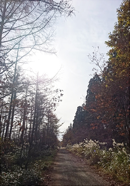
Torokawa Valley is one of Japan's 100 most secluded regions and the only one in Hyogo Prefecture.
Rice paddies cover the area downstream from Torokawa Valley. The rice from these fields was also awarded the highest prize several times over in nationwide competitions. For this course we recommend using a guide because of the long distance over varying elevations and the time that it will take to complete the course.
- 1) Hachikitakogen Family Ski Area
- Starting off from Hachikitakogen Family Ski Area, take the town road through Uwano Hachikita, and head for the Uwano Highlands. You will walk for about 6km on asphalt road with little traffic to worry about.
- 2) Uwano Highland Educational Cente
- From Uwano Highland Educational Center head in the direction of Itashino, after walking for about 1km there will be a signboard for "Torokawa Inari Shrine" on the left where you will enter the mountain trail.
- 3) Torokawa Inari Shrine
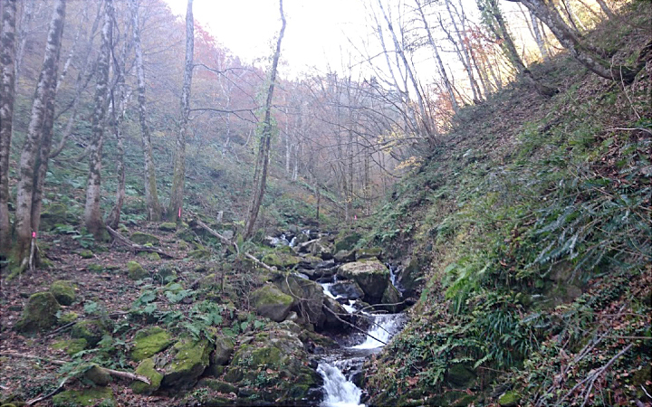
- You will arrive at the Torokawa Inari Shrine after walking for another 2km from there. Pass through the row of torii gates on your approach to the main shrine, here you can pray for safe passage on your hike. Many hikers that come here feel a sense of awe or fear when entering the realm of the god for some reason.
- 4) A large Katsura (Japanese Judas) tree
- 15 minutes from the shrine you will come face to face with the large Katsura (Japanese Judas) tree that is estimated to be 400 years old.
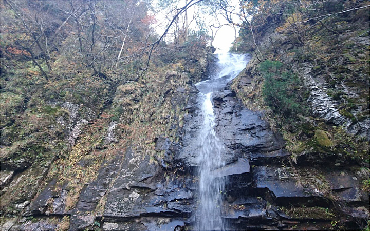
- 5) Soshinnotaki Waterfall / Fudotaki Waterfall
- Passing along the road to the side of the tree it will take about 40 minutes to reach the Soshinnotaki Waterfall / Fudotaki Waterfall a steadfast double waterfall. The height of this magnificent waterfall is 56m.
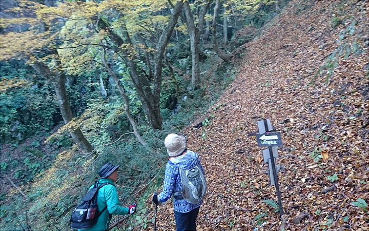
- 6) Path to the summit of Mt. Torokawa
- Going back the way we came we will take a path 50 meters before the large Katsura tree going to the right. We will take this path to the summit of Mt. Torokawa. Along the way we will pass through the beech forest.
- 7) Tajima Highlands woodland path for Mt. Hyonosen
- After a while, the path will come to the Tajima Highlands woodland path for Mt. Hyonosen. This is an unpaved road in the highland area called Torokawadaira and has a straightaway for about 2km. This road is popular not only with climbers, but also with many enthusiasts like off-road bikers who often visit here. Incidentally, this forest road represents the Hyogo prefecture and is 60km in length from Tokura Pass to Muraoka, but about two thirds of it is unpaved.
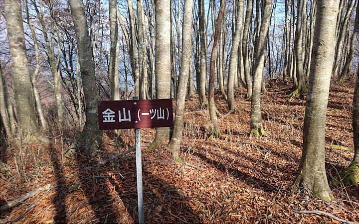
- 8) Forest road to Mt. Torokawa
- After passing through the straight of the forest road, there is a place to enter the forest on the left. Enter here and walk for 30 minutes, you will eventually reach Mt. Torokawa (elev. 1,039m).
Here, you can see the famous Hachikita Ski area of Mt. Hachibuse directly out front. Looking even further you can clearly see the peak of Hyogo's highest mountain Mt. Hyonosen. You can also survey the village of Hachikita below Mt. Torokawa.
- 9) Onuma high-rise marsh
- After walking for about 30 minutes there is a place that breaks to the left and will take you to Onuma. Onuma is a high-rise marsh and is inhabited by prized plants that grow in these wetlands, such as cinnamon fern and round-leaved sundew. In addition, surrounding the wetland are western Japan's largest Japanese elm trees. In the spring the area is covered with the beautiful flower of the soft windflower (Nirinsou / Anemone Flaccida).
- 10) Hachikita Family Ski Area
- After you have passed this area, you will arrive at the end of the course at Hachikita Family Ski Area.
- Route
- Hachikitakogen > Tajima Highlands Botanical Gardens > Uwano Highlands Outdoor Educational Center > Torokawa Inari Shrine > Torokawa Valley > Torokawa mountain trail > Torokawa woodland path > Mt. Torokawa > Noma pass > Hachikitakogen
- Difficulty
- ★★★
- Route Category
- Mountain and highlands
- Type of Activity


★☆☆ Flat course(Elevation gain less than 100m)or less than 5km.
★★☆ Slightly undulating course(Elevation gain less than 500m)or less than 10km.
★★★ Rugged course(Elevation gain more than 500m)or 11km.
★★☆ Slightly undulating course(Elevation gain less than 500m)or less than 10km.
★★★ Rugged course(Elevation gain more than 500m)or 11km.
| Distance | About 20km |
|---|---|
| Required Time | Walking time of about 10hrs |
| Starting Point | Hachikitakogen Family Ski Area |
| Getting Here | By Car: Drive by car to Hachikitakogen |
| Road Conditions | Asphalt / dirt / gravel |
| Resting Place | The Museum for wood culture, Torokawa Inari Shrine (with restroom) |
| Signpost Presence | Yes |
| Guide Availability | Available Send guide request to: Uduka no Mori Phone: 0796-96-0024 Fee/charge: JPY 3,500 |
| Notes | The trails are impassable during the winter. Shoes suitable for mountain hiking, such as trekking/hiking shoes are advisable. Portable restrooms are also suggested as there a limited number of restrooms along the way. You are required to bring a lunch, snack, and something to drink like water. |
| Contact | Contact: Uduka no Mori Phone: 0796-96-0024 |
 |
- Kinki Long-Distance Nature Trail - Mt. Taishi hiking course
- Nekozaki Peninsula Hiking Course
- Walk around Takeda Castle ruins and Teramachi Street
- The Famous Scenic "Kasumi Kaigan" Shiokaze Course
- Visit one of Japan's 100 most secluded regions, Torokawa Valley and Mt. Torokawa mountain trail.
- Mt. Sobu & Mt. Oosugii to Oonuka Mountain Trail
- Walking Hamasaka Town
- Yumura Onsen Course
- Moroyose Course
- Ueyama Highlands Course
- Tajima Mihonoura Course
- Home of Silkworm Culture - Osugi & Kuragaki Route
- Mining Town Walking Course in Akenobe
- View from Above the Sea of Japan - Aerial Train- Course
- Exploration of History Through Muraoka Castle Town
- Hachikita Kogen Scenic Walking Course
- Japan’s Most Beautiful Village - Tour Kami Town Ojiro & Kusube Valley Falls
- Japan’s Most Beautiful Village - Kami Town Ojiro, Giant Tree Forest, Yoshitaki Falls
- Walk Around Kuchiganaya in Ikuno Town
- Uduka History Course - Legend of the Rabbit Burial Mounds
- Uwano Nature & Interaction Forest Course
- Highland Course of a Shimmering Starry Forest and Pond
- See Oriental White Storks Dance in the Sky
- Walk the Town Where Oishi Riku Once Lived
- Along the Road Kinosaki Where Shiga Naoya Walked
- Blessings of the Earth, Walk Through the Town of Kawaminato
- Kannabe lava flow and crater course in a town where the world adventurer Uemura Naomi was born.
- A Course Through Serene Rural Landscape and a Rice Ball
- Japanese Heritage and Kitamae Ship Port "Moroyose Port" Course (Moroyose Short Course)


