A Course Through Serene Rural Landscape and a Rice Ball
心なごむ田園風景と里山おにぎりコース
 |
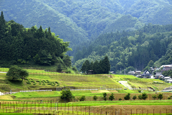
Walk through the clear mountain air and rice fields that use water from the lush mountains to grow their rice. Start from the old Kyo-kaido road, you will enjoy local time while stopping by peaceful shrines and temples.
Route map
Recommended Spots of Interest
- 1) Ichinomiya Shrine
- A shrine where a giant zelkova tree, estimated to be 500 years old, sits like a guardian deity. Keyaki no Mori (forest) is designated by Hyogo Prefecture as a natural monument.
- 2) Tenjin
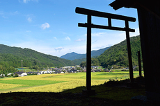
- A shrine dedicated to the god of learning, located overlooking the countryside and village.
- 3) Ninomiya Shrine
- The precincts of Ninomiya Shrine are located at the castle ruins of Governor of Wakasa, the ancestor of the former Ishitsubo family. Also, there was supposedly a mountain castle behind the shrine.
- 4) Sarusuberi (crape myrtle tree) Flower road
- A peaceful village with flowers that bloom smiles, that will have you feeling nostalgic about this place even on your first visit. You are invited to the place where city dwellers want to be.
- 5) Keihan Art "Okaeri (おかえり)"
- Keihan is the ridge between rice fields. This art is made by cutting back weeds to create messages that appear on the slopes. They will make you feel as if you've come home.
- 6) Nakaya
- Old private homes that have been made into a gathering place for the village. Here local traditions are handed down while eating and laughing around the traditional Japanese hearth.
- 7) Shingu Shrine
- Inside the shrine's main hall is a picture of the Nachi Falls and in the maido (stage) is a chrysanthemum crest. It is a reminder of Emperor Murakami 1050 years ago.
- Route Starting Point and Destination
- Start: Takahashi Community Center
Destination: Ikoinomori
- Difficulty
- ★★☆
- Type of Activity


★☆☆ Flat course(Elevation gain less than 100m)or less than 5km.
★★☆ Slightly undulating course(Elevation gain less than 500m)or less than 10km.
★★★ Rugged course(Elevation gain more than 500m)or 11km.
★★☆ Slightly undulating course(Elevation gain less than 500m)or less than 10km.
★★★ Rugged course(Elevation gain more than 500m)or 11km.
| Distance | About 5.6km |
|---|---|
| Required Time | Walking time of about 3 hours. |
| Start & Destination | Start: Takahashi Community Center Destination: Ikoinomori |
| Getting Here | By Car: Park at Kubata Parking Area |
| Road Conditions | Asphalt & dirt |
| Signpost Presence | None |
| Contact | Contact: Tanto Silkroad Tourism Association Phone: 0796-54-0500 |
- Kinki Long-Distance Nature Trail - Mt. Taishi hiking course
- Nekozaki Peninsula Hiking Course
- Walk around Takeda Castle ruins and Teramachi Street
- The Famous Scenic "Kasumi Kaigan" Shiokaze Course
- Visit one of Japan's 100 most secluded regions, Torokawa Valley and Mt. Torokawa mountain trail.
- Mt. Sobu & Mt. Oosugii to Oonuka Mountain Trail
- Walking Hamasaka Town
- Yumura Onsen Course
- Moroyose Course
- Ueyama Highlands Course
- Tajima Mihonoura Course
- Home of Silkworm Culture - Osugi & Kuragaki Route
- Mining Town Walking Course in Akenobe
- View from Above the Sea of Japan - Aerial Train- Course
- Exploration of History Through Muraoka Castle Town
- Hachikita Kogen Scenic Walking Course
- Japan’s Most Beautiful Village - Tour Kami Town Ojiro & Kusube Valley Falls
- Japan’s Most Beautiful Village - Kami Town Ojiro, Giant Tree Forest, Yoshitaki Falls
- Walk Around Kuchiganaya in Ikuno Town
- Uduka History Course - Legend of the Rabbit Burial Mounds
- Uwano Nature & Interaction Forest Course
- Highland Course of a Shimmering Starry Forest and Pond
- See Oriental White Storks Dance in the Sky
- Walk the Town Where Oishi Riku Once Lived
- Along the Road Kinosaki Where Shiga Naoya Walked
- Blessings of the Earth, Walk Through the Town of Kawaminato
- Kannabe lava flow and crater course in a town where the world adventurer Uemura Naomi was born.
- A Course Through Serene Rural Landscape and a Rice Ball
- Japanese Heritage and Kitamae Ship Port "Moroyose Port" Course (Moroyose Short Course)


